Traffic, Transportation
Disaster Management
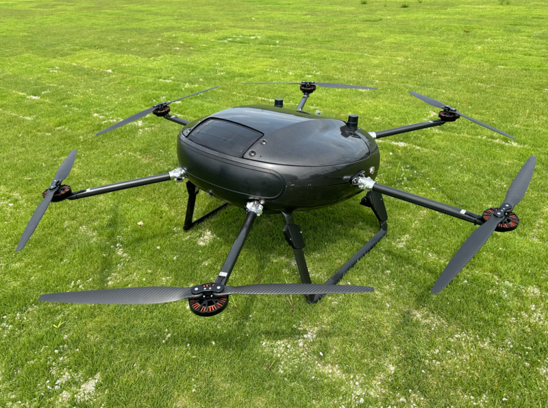
Survey of landslide and road collapse damage using the multi-use drone PF4

summary
The "PF4" is a multi-use drone developed on the premise of obtaining Type 1 Type Approval. In addition to basic logistics use, it can be used for aerial photography and survey use cases equipped with a camera, surveying use cases equipped with a laser scanner, and various other use cases.
Technical Strengths
Although battery-powered, it can fly long distances, up to 35 km with 5 kg of cargo on board. It also has high wind resistance with a maximum airspeed of 25 m/s, making it possible to fly in wet weather.
It can also utilize LTE signals from multiple carriers, enabling operation over a wide area regardless of signal conditions.
Case Studies (Including Demonstration Results)
- Municipalities served
- Wajima City, Ishikawa Prefecture
- Case Studies
- Landslide and road collapse damage survey
The drone survey provided an overall picture of the cracks and contributed to the initial investigation. Took approximately 35 minutes to photograph an area of approximately 22 km in length, completing a survey that normally takes several people 2~3 days to complete. - scale of implementation
- 5 people conduct a day-long survey in about 2~3 hours
- Time to delivery
- negotiable
- Price (if paid)
- Paid (trial price)
How to use in peacetime
Can be used in a wide range of operations, including logistics, aerial photography, and surveying. The company has particular strength in operations in out-of-sight areas.
ACSL Ltd.
- Location:
- 2F Hulic Kasai Rinkai Building, 3-6-4 Rinkai-cho, Edogawa-ku, Tokyo
- Website:
- https://product.acsl.co.jp/
- Year of establishment:
- November 2013
- Contact:
- Daisuke Sasaki ([email protected])


